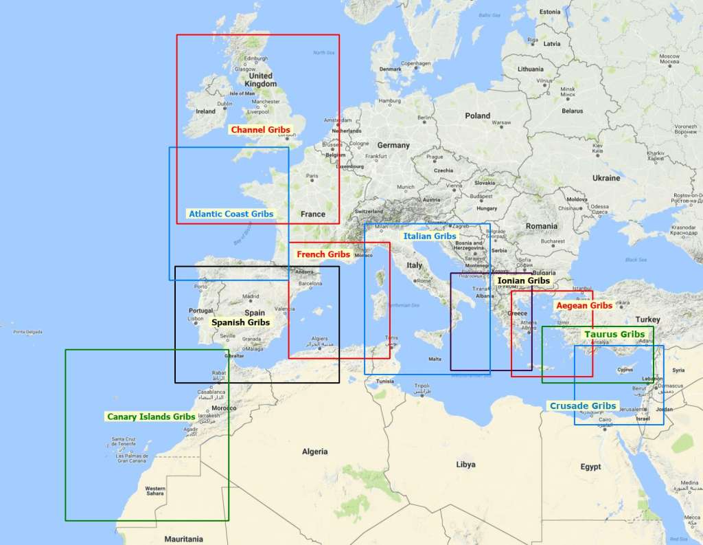
The OpenWRF Gribs provided here are produced by the author of the site using EMS-WRF with the latest Non-Hydrostatic Mesoscale Model (ARW) core. The model software is generously provided by NOAA but requires some patience and determination to achieve a hands-free production.
The unique value offered by these products is that they are produced by a non-hydrosatic high resolution regional model that performs well in modeling local weather phenomena in comparison with global models such as the GFS which are hydrostatic models and by definition they model the synoptic scale of weather better than the mesoscale of regional/local weather phenomena.
In our production runs each main domain has a12km grid and the nested domains have 4km grids. Initialization is with current analysis meteorological data. Boundry conditions are provided by GFS forecast data. The domains have pre-generated high reslolution topography and coverage data as required by the physics of the model.
The runs are performed in parallel on four Linux clusters each consisting of two second hand HP DL360 G6 servers each with 2 Xeon 5650 CPUs and 12GB memory. In addion two stand alone Linux servers are also used for production. This give a total of 124 physical CPU cores for processing. Production runs take between 50 to 80 minutes plus about 15 minutes to publish.
Sea current data is generated by E.U. Copernicus Marine Environment Monitoring Service using the NEMO model and is added to the Grib files
Finally, the WAM wave data included in these gribs is also generated by E.U. Copernicus Marine Monitoring Service using the WAM cycle 4.5.4 model driven by ECMWF wind data.
What next?
I plan to add more daily runs at different times to produce other sailing grounds in the Med and beyond. This is dependent on obtaining more server resources. Offers are welcome.
Keep an eye on the upcoming additions.


